
價格:免費
更新日期:2019-06-26
檔案大小:130.1 MB
目前版本:2.2.3
版本需求:需要 iOS 10.0 或以上版本。與 iPhone、iPad 及 iPod touch 相容。
支援語言:英語
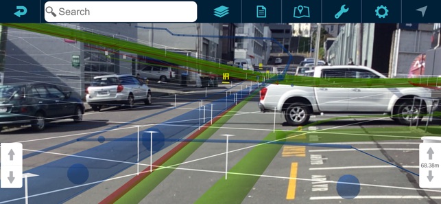
Augview is an augmented reality application that enables the user to display and visualize infrastructure asset data. It has been developed for field service personnel who require online access to a variety of GIS and asset management systems via the internet. Augview provides traditional GIS map views of the asset data plus an augmented reality mode that displays 3D objects of the networks overlaid over the video stream.
Features
* 2D map
* 3D augmented reality mode

* Multiple GIS systems supported (ESRI Rest API, Smallworld, WMS/WMTS/WFS/WCS)
* Supports Digital Elevation Models
* Combines multiple GIS data sets into one map (Data access is based on pre-arranged permission)
* Database interrogation
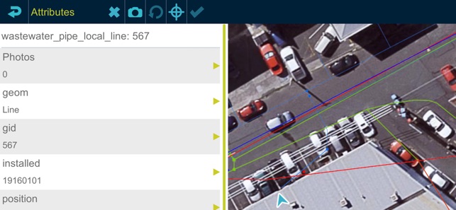
* "Live" attribute and spatial updates (requires “write” permission from the data administrator)
* Photo capture with geotagging and association with an asset

支援平台:iPhone, iPad