
價格:免費
更新日期:2019-06-01
檔案大小:41.8 MB
目前版本:3.6.7
版本需求:需要 iOS 11.0 或以上版本。與 iPhone、iPad 及 iPod touch 相容。
支援語言:英語
Tactical NAV was created by a U.S. Army Field Artillery officer who was deployed to Afghanistan with the 101st Airborne Division (Air Assault). While deployed, he saw a need for an MGRS-focused smartphone application that every Soldier and service-member in the world could utilize -- something the Department of Defense wasn't taking advantage of despite their massive budget of hundreds of billions of dollars.
The original intent behind the app was to create a low-cost, accurate, and effective mobile navigational solution for military service-members that was built for accuracy. It allows users to pinpoint their location with precision accuracy, and acquire an MGRS/UTM/BNG/LAT-LONG coordinate to any location, anywhere in the world. Its performance is on par with the AN/PSN 13 Defense Advanced GPS Receiver (DAGR) and has been tested and used in combat. It has also been evaluated against other software systems the DOD uses such as CPOF, BFT, and other targeting solutions the Pentagon utilizes for target acquisition.
FEATURES:
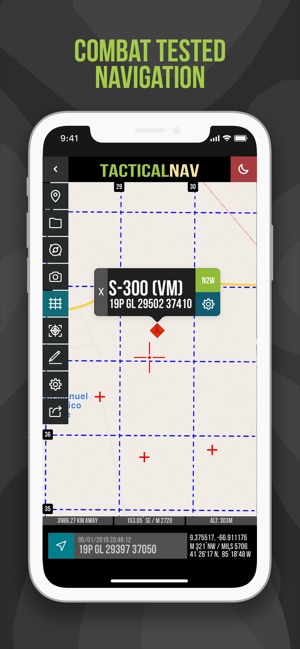
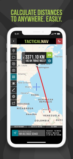
- Military quality GPS tactical navigation system
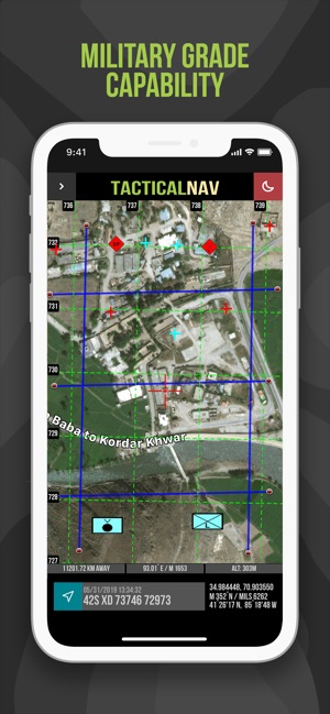
- WGS 84 standard and includes MGRS, UTM, BNG and USNG
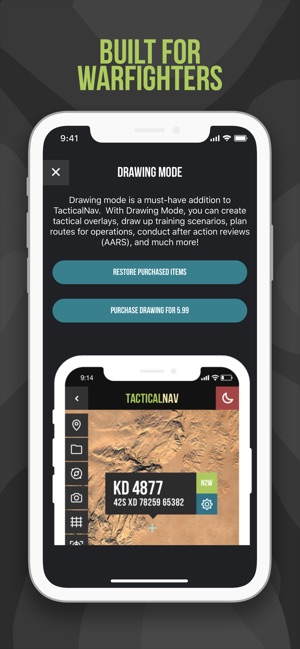
- Sandtable drawing mode (In app purchase)
- Navigation mode
- Scalable gridlines with grid designators
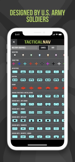
- Waypoint plotting functionality with military graphics
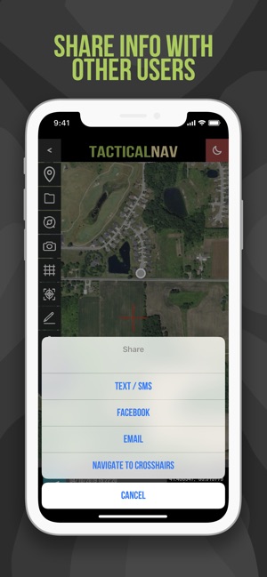
- Location and waypoint sharing via email, text and Facebook with other users
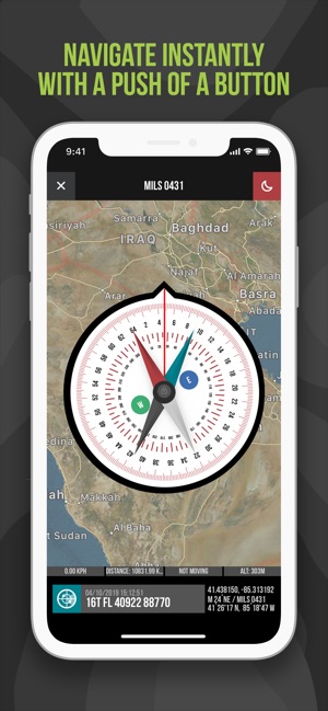
- Compass “FastLock” function for capturing quick azimuths
- Quickly swipe between various types of coordinate and location data
- Camera mode with data displayed in real-time and photo stamping capability
- One-button night mode function for low-light situations
- "Go to Grid" option for pinpoint planning and drawing of overlays
- Tested in combat to ensure utmost accuracy and reliability
- And much more!!!
MEDIA COVERAGE:
Featured in the Army Times, BBC, CNN, CBS News, FOXNEWS, MSNBC, the DailyMail, the NY Times, and many more!
===================
Bottom line, Tactical NAV puts the Military Grid Reference System (MGRS), the British National Grid (BNG), Universal Transverse Mercator (UTM), and the United States National Grid (USNG) at your disposal. Yes, you can now finally access the same resources used by the U.S. military and NATO armed forces. And it's just as accurate as anything the U.S. government and NATO uses today.
Soldiers and service-members will appreciate how TACNAV can help them in the field. Map, plot, photograph, and share navigational points with other users. Find your way back to an observation post, employ the night mode function for easier viewing in the dark, and switch quickly between different types of coordinate data and take advantage of the camera mode for real-time and photo stamping capabilities, and build overlays for mission planning, too.
Everything you need is here, and has been extensively tested for accuracy in the remote mountains of Kunar Province, Afghanistan, during combat operations. Tactical NAV is on par with many of the GPS devices used by Soldiers and service-members today, and is just as accurate as devices (referencing the DAGR) costing thousands of dollars.
Do yourself a favor. Download Tactical NAV now and put a portable, military-quality tactical-navigation software solution to work for you.
IMPORTANT NOTES:
Tactical NAV is not endorsed by the Department of Defense nor should it be used in combat situations in place of a government issued device.

支援平台:iPhone