
價格:免費
檔案大小:14.1 MB
版本需求:需要 iOS 12.0 或以上版本。與 iPhone、iPad 及 iPod touch 相容。
Q8Sea app [Kuwait Sea] is a navigation apps system for Kuwait water and areas.
This apps was setup for number of option for user as:
1- Fishing Area Locator.
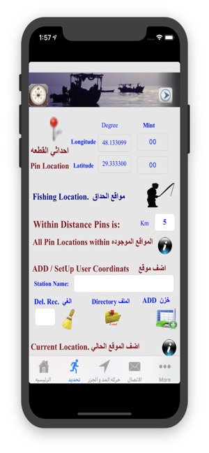
This apps has about 150 fishing area in Kuwait terrtorial water were stored in and can be navigated
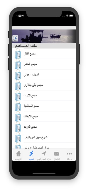
to.Also has the ability for user to create his own data file.
This app can display for user all around fishing area within setup distant from current location or
any selected location in kuwait waters by dropping pins [showing the name, longitude and latitude for
each location].
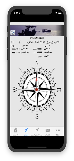
Q8Sea app uses two way to Navigate to selected fishing area which are:

-By displaying a google map with user location and selected location to navigate to.
-By built in Compass showing the Selected location to navigate to.Also showing Distant and angle
from your location and selected location.
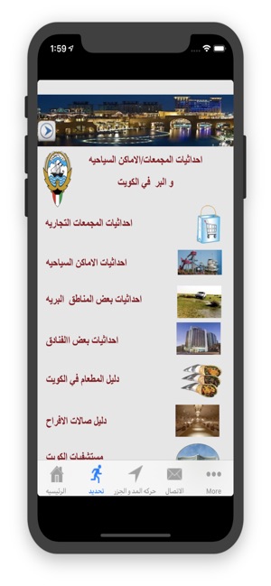
2- Locating Areas of Interest in Kuwait City such as:
-Shopping Center
-hotels
-Camping Areas
-Entertainment Places
-Different type of Restaurants
-Wedding Lounges
-Hospitals (Public and Private)
where user can navigate to by the app.
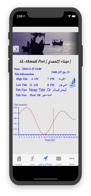
3- For Fisher, Q8Sea app show daily hydrodynamic information prediction (Tide Level info.) from
different station in Kuwait waters. Displaying a 24 hour tide data and graph.
The app requesting the current location
To use of this option for the following:
1- From current location user can set the distance from the current location pin at [With Distance pin is:] to allocate all fishing area around or within the
selected distance or the nearest fishing area from current location.
2-By Touch on the map at any selected location in Kuwait waters to drop a pin and then set the distance from the pin location at [ With Distance Pin is] in
KM to allocate all fishing area around within selected distance or the nearest fishing area from selected location pin.
3-Also to know user current location is used to calculate the distant from user location to final distanation [the selected fishing area] want to go to.
and also to update what distance left to reach the selected fishing area.
4-Also to know user current location is used to calculate the angle between user location [current location ] and the selected fishing area location. The angle
used in the Compass to show the direction and also updated the angle in the app.
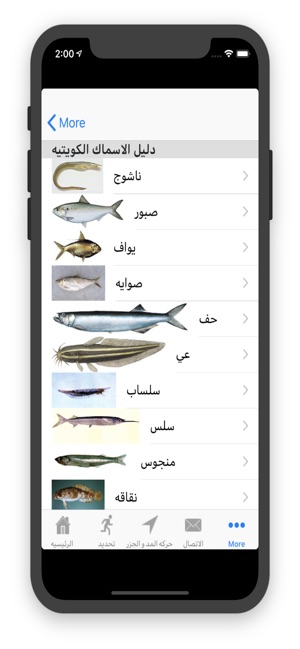
Q8Sea app can display images and names about all fish type in kuwait water.
Q8Sea app can share result by Email, Whatapps or SMS with an image attached
For more Information on the App go to website at:
-http://hceatkuwait.net/request/kpsl.pdf
-http://hceatkuwait.net/request/Data_iphone.htm
هو نظام تطبيقات ملاحة للمياه والمناطق في الكويت.تطبيق [Kuwait Sea] Q8Sea
تم إعداد هذه التطبيقات لعدد من الخيارات للمستخدم على النحو التالي:
افضل مواقع منطقة الصيد الاسماك.
هذه التطبيق لديه حوالي 150 منطقة الصيد في المياه الكويت تم تخزينها ويمكن أن تنتقل اليها
لديه القدرة للمستخدم لإنشاء ملف البيانات الخاصة به.
يمكن لهذا التطبيق عرض للمستخدم جميع مواقع الصيد حول الموقع الحالي أو
أي موقع مختار في مياه الكويت بإسقاط دبابيس [يوضح الاسم وخط الطول وخط العرض لـ
كل منطقة].
تحديد المناطق ذات الاهتمام في مدينة الكويت
-مركز التسوق
-الفنادق
مناطق التخميد
-اماكن ترفيهية
- انوع مختلفه من المطاعم
- صالات احتفالات العرس
-المستشفيات (العامة والخاصة)
حيث يمكن للمستخدم الانتقال من خلال التطبيق
يعرض ايضا التطبيق تنبؤات يومية للمعلومات الهيدروديناميكية (معلومات مستوى المد والجزر
لي اماكن مختلفة في مياه الكويت. عرض بيانات المد والجزر على مدار 24 ساعة.

支援平台:iPhone