
價格:免費
更新日期:2018-09-18
檔案大小:54.5 MB
目前版本:5.5
版本需求:需要 iOS 9.0 或以上版本。與 iPhone、iPad 及 iPod touch 相容。
支援語言:丹麥文, 巴克摩文挪威文, 德語, 法文, 瑞典文, 芬蘭文, 英語, 荷蘭文, 西班牙文
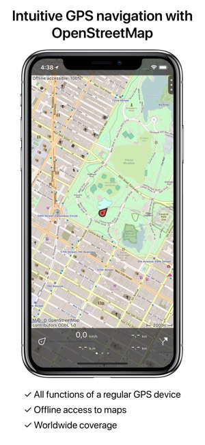
Intuitive GPS navigation using OpenStreetMap.
Makes from your iPhone/iPad a complete GPS device including a route planner based on the detailed and clear OpenStreetMap. The maps will be saved on the iPhone/iPad, so that Topo GPS can also be used without an internet connection.
Why should you buy an expensive GPS device if you can install Topo GPS on your iPhone/iPad? Topo GPS contains all functions of a regular GPS device for less money, has a much more detailed map, and is much more convenient to operate. The accuracy of the position determination is in favorable conditions about 5 m.
Ideal for walking, hiking, cycling, mountainbiking, sailing, horse-riding, geocaching, scouting, and other outdoor activities. Also suited for outdoor professionals.
Topo GPS contains:
- Map
* Complete OpenStreetMap by MapQuest (no hidden costs)
* Detailed maps, with buildings, cultivation, and roads including the smallest forest trails.
* Map tiles are saved automatically on the iPhone/iPad and can be viewed off-line.
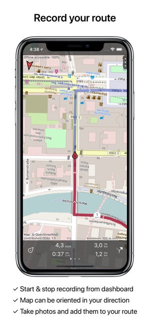
* Map can be oriented in your direction
- Intuitive interface
* Clear menu with most important functions (top right)
* Different dashboard panels (bottom) with distance, time, speed, altitude and coordinates.
* Clear manual on http://www.topo-gps.com/manual/html
- Current position
* Position and movement direction indicated by arrowed marker.
* Displayable in WGS84 decimal, WGS84 degree minutes (seconds), UTM and MGRS.
* Sharing via iMessage/E-mail/Facebook/Twitter.
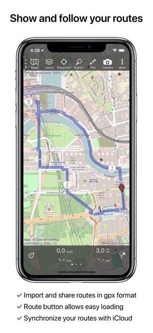
- Planning, loading and recording routes
* Easy recording routes via one-click on clock of dashboard, with pause and
restart possibility.
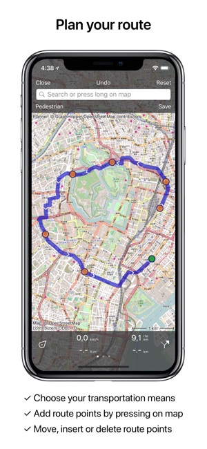
* Planning of routes from A to B using different transportation means
(pedestrian/bicycle/car).
* Planning of routes via different route points.
* Planned routes are automatically drawn over roads.
* Planned and recorded routes can be easily edited.
* Importing routes in .gpx format and zipped .gpx format from internet
and e-mail.
* Sharing recorded and downloaded routes in .gpx format via e-mail, Facebook, Twitter and with Topo GPS.
* Free access to route collection Topo GPS with lots of nice routes.
* All map tiles of a route can be saved on the iPhone/iPad with a single click.
* Routes can be organized into folders.
* Photos can be taken in the app and will be included in recorded routes.
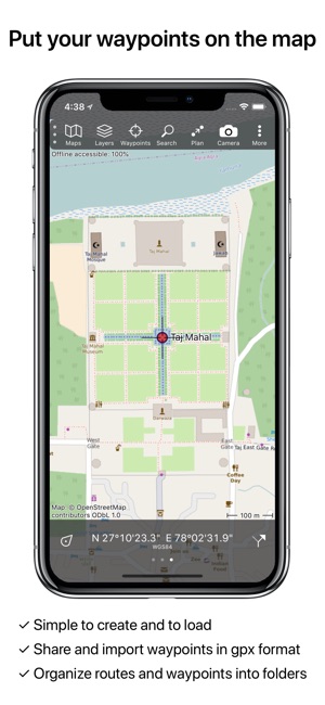
- Waypoints
* Adding waypoint through address, current position or coordinates.
* Supported coordinate systems: WGS84 decimal, WGS84 degree minutes (seconds), UTM, and MGRS.
* Waypoints can be used to plan a route.
* Waypoints can be organized into folders.
* Sharing via Message/E-Mail/Facebook/Twitter.
* When taking a photo, it will be automatically added to a waypoint.
- Cache
* Shown map tiles are saved automatically on the iPhone/iPad.
* All tiles of the current area or a route can be downloaded into the
cache with a single click.
- In app purchases
* Topographic maps of Belgium, Denmark, Finland, France, Great Britain, the Netherlands, New Zealand and Norway.
If you are recording a route, the GPS will run in the background. Continued use of GPS running in the background can dramatically decrease battery life.
Rdzl, the company behind Topo GPS, does not obtain in any way the position of the user of Topo GPS. Rdzl does also not obtain the routes recorded by the user, and save the routes planned by the user, unless the route is shared with Topo GPS. We sell our product, not our user data.
支援平台:iPhone, iPad