
價格:免費
檔案大小:39 MB
版本需求:需要 iOS 10.3 或以上版本。與 iPhone、iPad 及 iPod touch 相容。
支援語言:英語
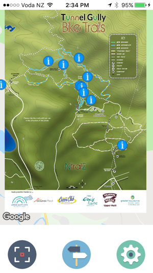
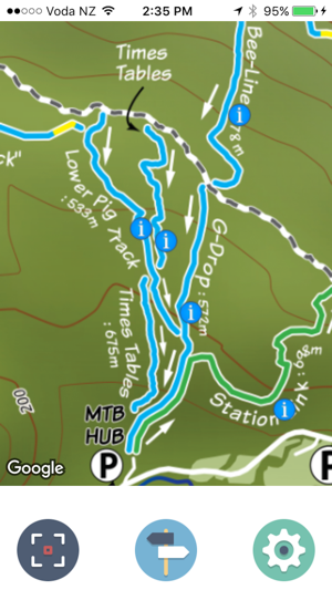
The initial release of NtrailZ covers trails in the Tunnel Gully Bike Trails area of Upper Hutt, Wellington, New Zealand. Future releases will include new trails at Tunnel Gully and Kaitoke in Upper Hutt and other Bike Parks and areas within the Wellington region. In the future we will be taking NtrailZ further afield to cater for other bike trails within New Zealand and who knows maybe eventually other bike trails and parks around the world.
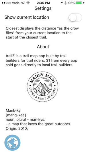
As stated in the promo text and within the app, $1 from every app sold will be given back to the local trail builders that the particular map/app release covers. In the initial Tunnel Gully release $1 will go back to the NtrailZ crew from Upper Hutt.
Features:
- Uses GPS to show your current location and the closest trail head to your current location
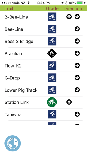
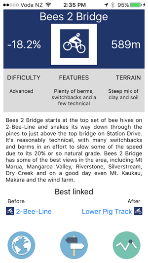
- Includes grade, direction indicators, average gradient, length, difficulty, features, terrain, description and best linked before or after for every trail
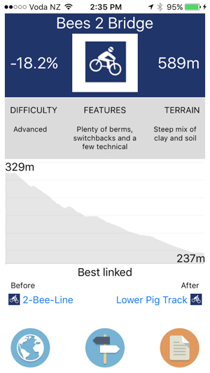
- Includes elevation profile for every trail

- Lists all trails within the park or area
The overlay map that features in the Tunnel Gully release has been done by Manky Maps - Design and print on cloth and when the currently proposed new trails for Tunnel Gully become finalised, a Manky (map on a hanky) will be produced and will be available at local Upper Hutt outlets or from the NtrailZ club website or Tunnel Gully facebook page.
支援平台:iPhone