
價格:免費
更新日期:2018-06-12
檔案大小:155.8 MB
目前版本:2.0
版本需求:需要 iOS 11.0 或以上版本。與 iPhone、iPad 及 iPod touch 相容。
支援語言:英語
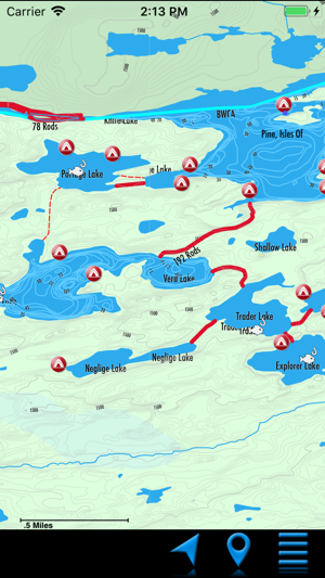
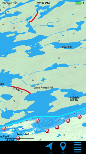
Experience a level of confidence like never before when paddling the Boundary Waters Canoe Area and Quetico with PaddleNav, the first detailed iOS map of the canoeist's paradise, based on our very popular line of GPS maps. Most importantly, this map works offline, so no cell network access is required, a valuable feature in this remote wilderness area. Map features include:
•Hand edited and verified for accuracy
•Most detailed map data available
•Lakes, rivers, streams, elevation - no other GPS maps needed
•Depth lines on over 100 BWCA lakes
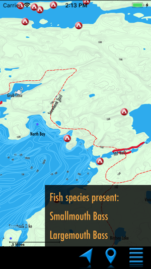
•Fish species info for hundreds of BWCA lakes
•BWCA campsites, portages, and entry points
•Quetico portages
•Portage lengths
•Thousands of geographic points of interest
•Hiking Trails - Old Pines, Kekekabik, etc.
Continued use of GPS running in the background can dramatically decrease battery life.

支援平台:iPhone