
價格:免費
更新日期:2016-09-18
檔案大小:677.2 MB
目前版本:2.7.4
版本需求:需要 iOS 9.3 或以上版本。與 iPhone、iPad 及 iPod touch 相容。
支援語言:德語, 英語
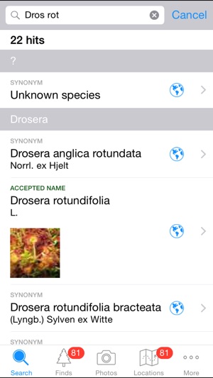
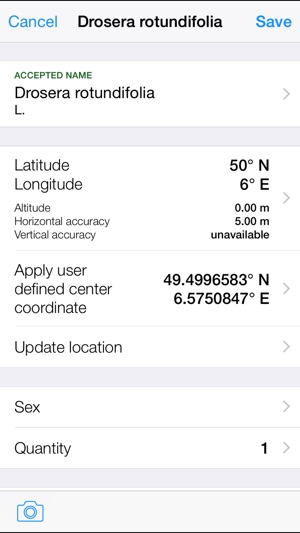
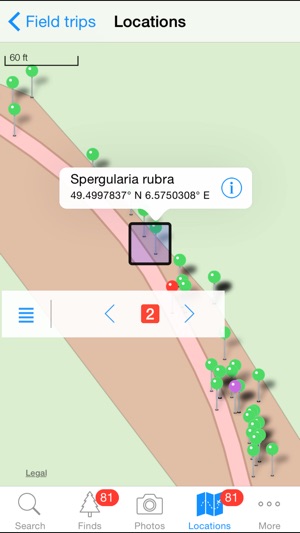
Eco:Map is a professional tool for mapping plants and animals as well as for biomonitoring with surveys on iPhone, iPad or iPod. Devices with a GPS unit determine the coordinates of each find automatically. For each find you can store a number of additional attributes e.g. the sex of a species. Each find can immediately be displayed on a map.
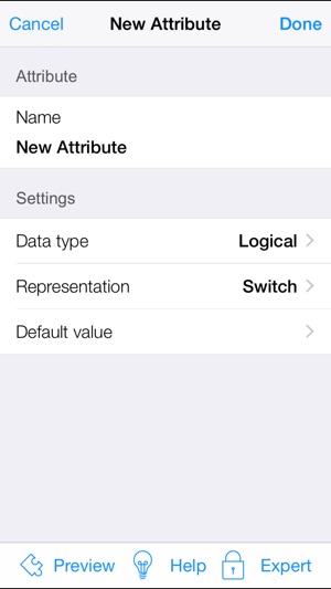
Users who want to define their own attributes are able to do so by defining them while editing data. An easy-to-use editor supports enables you to design entire new forms which can be shared with other users.
Eco:Map comprises fifteen preset international, German and European databases among them the „Catalogue of Life“ released by Species 2000 and ITIS. The latter one contains more than 2.34 million scientific names and synonyms and 70,000 English names of all organisms world wide.
Besides that Eco:Map is able to import user defined databases.
For further processing in other databases and applications you can export your data in the formats CSV, Simple Darwin Core, KML (Google Earth), and GPX. You decide whether you transfer a field trip's data to your computer via e-mail, via a browser in a local area network or via iTunes.
Eco:Map enables you to take photographs within the app which you can view in a slide show. These photographs can be transferred to your computer just like any other data.
Apple-approved Education institutions in the United States can get a discount when ordering Eco:Map.
支援平台:iPhone, iPad