
價格:免費
更新日期:2017-02-01
檔案大小:5.9 MB
目前版本:1.2
版本需求:需要 iOS 8.0 或以上版本。與 iPhone、iPad 及 iPod touch 相容。
支援語言:英語
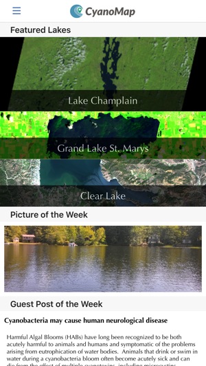
Parents, Swimmers, Fishermen, Public Health Officials: Stay informed on water quality and reduce your exposure to potent toxins. Toxic cyanobacteria (blue-green algae) are a growing health hazard. CyanoMap uses multiple satellites and massive computing power to track harmful algal blooms (HABs) and monitor lake conditions near you.
PRODUCT FEATURES
Data collected from multiple satellites operated by international space programs
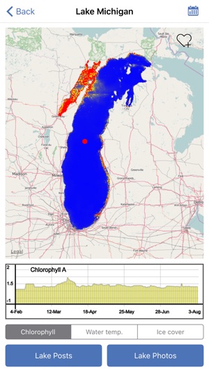
Comprehensive, regular data on chlorophyll-a concentrations and lake surface temperature
Near real-time information on HAB events
Coverage of thousands of lakes across the United States
Interactive maps
Lake centric community blogs
Georeferenced lake photos
Citizen scientist and crowd sourcing tools
Climate and earth data records
HARMFUL ALGAL BLOOMS
Cyanobacteria are photosynthetic bacteria that can reproduce explosively in nutrient rich aquatic environments, forming blooms. Many blooms are intensified by human activity, particularly pollution from agricultural runoff. Besides being foul-smelling and unsightly, cyanobacterial blooms have the capability to generate toxins which have caused deaths in animals, serious illness in humans, and adverse economic impacts.
With chronic exposure to cyanobacterial toxins now also linked to an increased risk of developing neurological disorders like amyotrophic lateral sclerosis (ALS), it is more important than ever to be aware of local water quality.
CYANOMAP
We aim to provide the best possible information to help you gauge lake conditions and avoid exposure to cyanobacterial toxins.
Use CyanoMap to:
Assess lake conditions for health concerns
Search and browse lakes of interest to you
Keep informed on the latest water quality conditions
Share member posts about any lake
Share photos of lake conditions, recreation, and scenery
Conduct scientific investigations of lakes
Support lake programs
CYANOMAP VS TRADITIONAL MONITORING
In the past, water quality monitoring has always involved someone going to a water body, scooping up some water, and then testing that water. This is time consuming, expensive, and not feasible over large areas. Satellites, on the other hand, can continuously observe many lakes in their entirety, providing much more data than a few point samples scattered among a few lakes. CyanoMap allows you to access this body of data through our advanced yet straightforward delivery platform.

CyanoMap is supported by NIH, NASA, NSF, and other sources. We follow an open source and transparent approach to deliver the best information to end users.
支援平台:iPhone