
價格:免費
更新日期:2017-06-12
檔案大小:16.2 MB
目前版本:8.1.0
版本需求:需要 iOS 7.1 或以上版本。與 iPhone、iPad 及 iPod touch 相容。
支援語言:德語, 法文, 義大利文, 英語, 荷蘭文, 葡萄牙文, 西班牙文

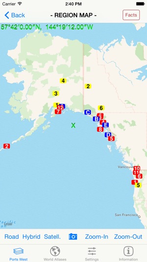
Our zoomable 'Cruise Ports - West' map atlas is a specialized product that covers popular saltwater cruise ship ports in the entire Western Hemisphere (from the Aleutian Islands to Cape Horn in South America) and is available in the languages of English [the Default], Spanish, French, German, Italian, Netherlands [Dutch], Portuguese (Europe), and Portuguese (Brazil). It generates a series of custom real-time regional maps showing colored markers where popular cruise ports (and related destinations) are located. Also included are maps and facts for each of these ports [red & orange markers] and for related slow-cruising locations [blue markers] and nearby popular land destinations [yellow markers].
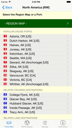
Using the 'Ports West' tab, select the region of general interest by tapping the desired area on the red map of the Western Hemisphere. A list of available numbered destinations in that selected region will then be displayed, as well as a button to display an overview map of the selected area showing colored markers at the locations of all of the popular destinations in that area. Tap the name of the desired destination in the list to display a detail map of that destination.
If you give permission in the Privacy Settings of your device, this version will also show your current location on the maps as a pulsating blue circular marker. If you adjust the map being displayed, your current location will be automatically updated using your device's GPS location.
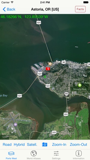
Easily switch between 'Road', 'Hybrid', or 'Satellite' maps, and zoom in (and out) to any detail level desired -- down to the house level! Change to a different area of focus with the drag of a finger and your display is instantly updated.
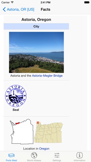
Tapping a 'Facts' Button, when shown, displays extensive relevant interactive descriptive information from Wikipedia. By following indicated links, more facts and photos are available in a specific areas of interest.
Using a new 'Settings' tab, you can select the GPS Coordinates format to be displayed on all maps, or omit it. Three different popular display formats are supported: Traditional [dddmmss.xx] , Modern [ddd.xxxxx], and Geocaching [dddmm.xxx]. As you drag or zoom on a map display, the GPS coordinates of the center of the display are automatically updated.
Tap the camera icon to quickly capture the created map image to your device's Photo Gallery. [Later you can print or share this image with others via Facebook, Twitter, Flickr, or email using the Apple-provided 'Photo' app.]
Using the 'World' tab, tap an appropriate button to launch any of the other component apps in our World Atlas series that are installed on the device.
支援平台:iPhone, iPad