
價格:免費
更新日期:2018-04-13
檔案大小:50.7 MB
目前版本:1.3.4
版本需求:需要 iOS 8.0 或以上版本。與 iPhone 及 iPad 相容。
支援語言:德語, 法文, 義大利文, 英語, 西班牙文
Check your business from fields
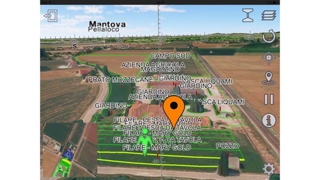
• 3D Navigation and comparison of what you see, against SITI4farmer data network
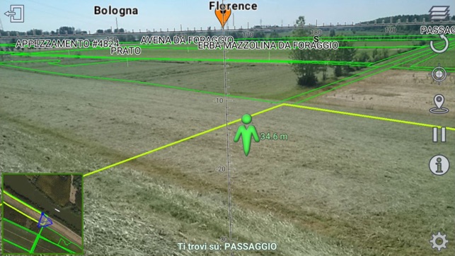
• Take advantage of Augmented Reality for powering your company from farmland
• Get measurements about lengths and heights
SITI4land is a SITI4farmer APP of Augmented Reality. SITI4farmer is a professional network for agriculture (www.siti4farmer.eu) and the best tool for increasing farmland control.
DESCRIPTION
SITI4land displays 3D terrain data, with an impressive detail, using digital terrain models from laser scanning (LiDAR) and high resolution calculation of aerial images.
Advanced Augmented Reality features show detailed layers of information on the framing area, considering land morphology, vegetation, buildings and vector catalogs to define the farm and his farmland.
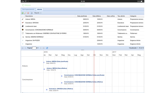
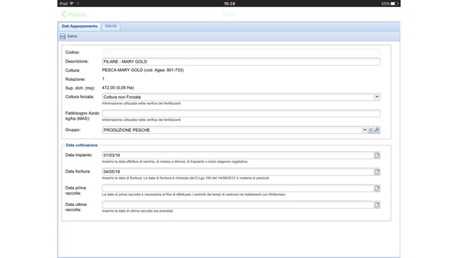
The combined use of the S4l APP with SITI4farmer cloud software, allows you to take on the field Agricultural Practice planning and record on-site all the performed activities.
MAIN FEATURES
- 3D terrain with high detail (up to 20 cm)
- Augmented Reality with vector data layers and 3D virtual display
- Aerial High resolution pictures
- Topographic maps

- Points of interest (POI) Labels / 3D icons
- Searching feature by place name
- Distances and height calculation
- Acquisition and recording pictures in Augmented Reality
- Registration of agricultural practice and compiling law required records
- Phenological dates crop recording
- Acquisition and recording pictures in Augmented Reality
- Real time issue reporting
- SITI4farmer real time synchronization
支援平台:iPhone, iPad