
價格:免費
更新日期:2018-10-13
檔案大小:35.7 MB
目前版本:2.1.1
版本需求:需要 iOS 10.0 或以上版本。與 iPad 相容。
支援語言:英語
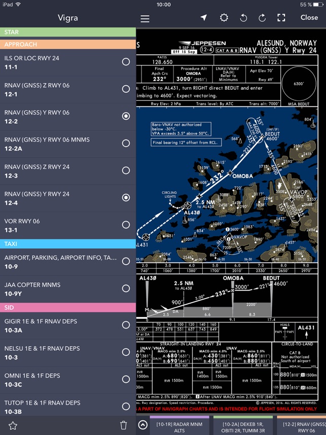
Are you into flight simulation? Navigraph Charts is the preferred charts app in the flight simulation community offering the largest coverage available of Jeppesen charts updated continuously every 28 days following the AIRAC cycle.
Navigraph Charts allows you to search, view and organize airport charts from 6,800 airports around the globe. You can connect it to FSX, Prepar3D or X-Plane, to plot your position on charts, or use it independently to plan your route.
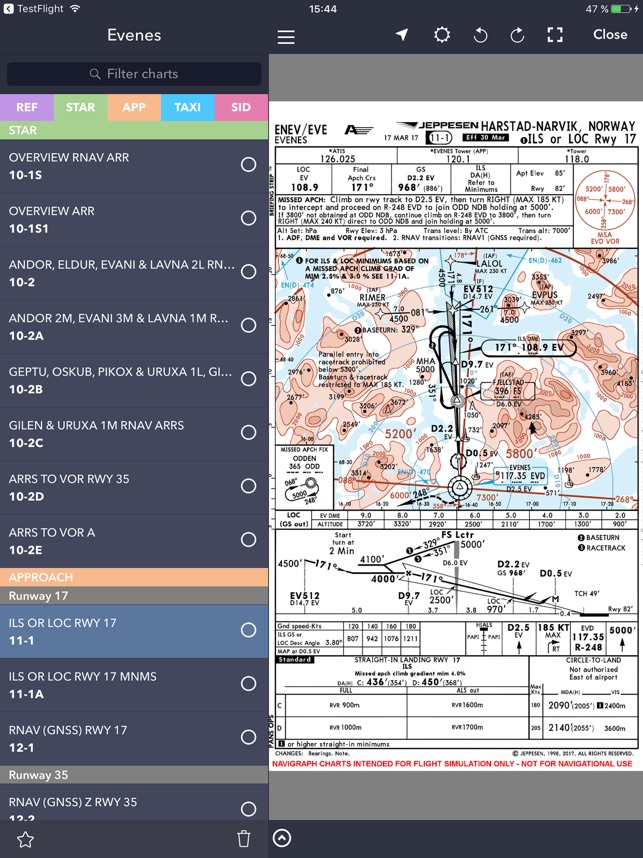
In this release (fall 2018) we have included Commercial Airline Overlay (CAO) charts in addition to the standard Instrument Flight Rules (IFR) charts. CAO charts were developed to better support pilots that primarily operate category C and D aircraft. It uses Constant Descent Final Approach (CDFA) technique whenever possible; has a to-scale approach chart depiction of Minimum Safe Altitude (MSA); and features DME reference circles to show relevant distance and radial information to a suitable VORDME, ILS/LOC DME, stand-alone DME or TACAN.
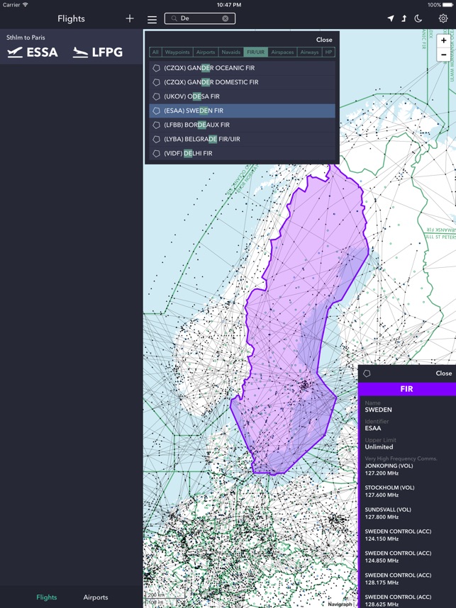
In previous releases we have also added an interactive and scalable high and low airspace enroute chart with route visualization and moving maps functionality. In coming releases we plan to add procedure visualization and Visual Flight Rules (VFR) charts.
Navigraph Charts can be used for free in a feature complete demo version which includes access the airports in Alicante, Spain (LEAL) and Ontario, CA, US (KONT). The enroute chart has no area restriction.
Navigraph Charts contains the following features:
Worldwide and current Jeppesen IFR charts: 6,800+ airports covered (requires Navigraph subscription)
Moving maps: connect to X-Plane, FSX and Prepar3D to show the simulator's aircraft position on the charts in real time (requires Navigraph Simlink on simulator computer)
Night mode: Dark theme version of the charts for low ambient light conditions
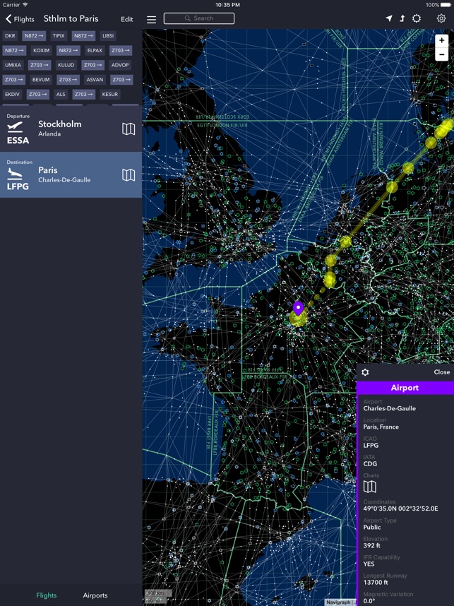
Flight organization: Collect charts for departure, destination and alternates in a single place
Chart color coding and pinboards: Easily filter specific chart types and pin charts for quick access
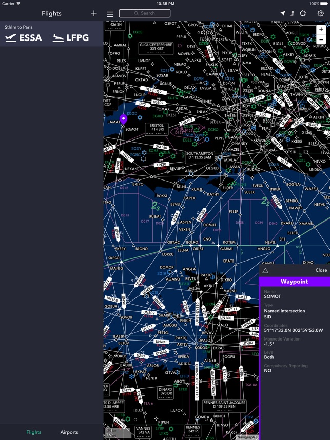
Interactive enroute charts: Click and search airports, waypoints, navaids, airways, controlled and restricted airspaces, FIRs/UIRs, holding patterns and more
Route visualization: Show your flights route on the enroute charts
For the ultimate experience we recommend subscribing to Navigraph Ultimate which ensures that you are always flying using the most recent charts and navdata used by all online pilots and air traffic controllers in the flight simulation community.
Navigraph Ultimate includes, in addition to worldwide charts access, updated navdata parsed into more than 120 different addon formats including aircraft like PMDG B737/747/748/777, Qualitywings B787, Flight Factor A320, IXEG 737 and many more. Navigraph Ultimate also includes regular updates to the navigation databases in flight simulators such as X-Plane 11.
Please note that:
- This product is for home flight simulation use only and must not be used for real world navigation.
- This product is free to use in demo mode but requires a Navigraph account.
- This product requires a Navigraph Charts or Navigraph Ultimate subscription for full access to all airport charts.
Pro tips:
- We recommend that you install Navigraph Charts on your desktop too. All changes you make to Flights, Bookmarks, and Pinboards are immediately reflected on your tablet.
- With a current Navigraph Charts or Navigraph Ultimate subscription you can also access airport charts in the virtual Electronic Flight Bag (EFB) on the virtual flightdeck of many addon aircraft.
支援平台:iPad