
價格:免費
更新日期:2018-07-11
檔案大小:64.2 MB
目前版本:3.2.2
版本需求:需要 iOS 9.3 或以上版本。與 iPhone、iPad 及 iPod touch 相容。
支援語言:俄文, 土耳其文, 希伯來文, 德語, 日語, 法文, 簡體中文, 繁體中文, 義大利文, 英語, 葡萄牙文, 西班牙文, 阿拉伯文, 韓語
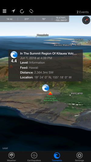
Natural Disaster Maps provides maps for weather, earthquakes, and tsunamis from NOAA (National Oceanic and Atmospheric Administration), the USGS (United States Geological Survey), the PTWC (Pacific Tsunami Warning Center), and NASA (National Aeronautics and Space Administration).
Whether you are monitoring a storm and want to see real-time warnings, checking the size of a recent earthquake, wondering if there has been a tsunami warning issued, or tracking a hurricane, this app is for you!
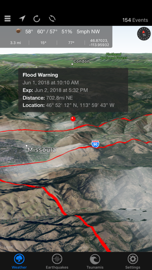
Weather
- Real-Time NOAA weather events map
- Near real-time NOAA events map
- Doppler radar (updated every 10 minutes) map layer
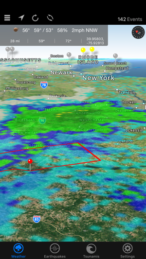
- Clouds (updated every 3 hours) map layer
- 30 minute precipitation accumulation map layer
- 3 hour precipitation accumulation map layer
- 24 hour precipitation accumulation map layer
- Current hurricanes and typhoons (tropical cyclones) map layer
- Temperature, humidity, wind speed/direction, and forecast
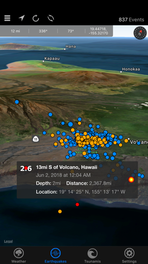
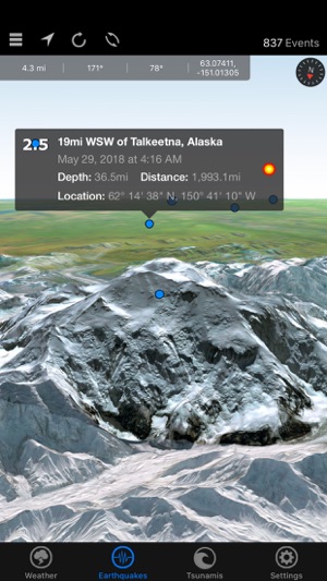
Earthquakes and Tsunamis
- USGS earthquake events map
- Sort and filter earthquakes by magnitude, distance, and depth
- Pacific and Atlantic ocean tsunami events map
- Tectonic plates map layer
- Active volcanoes map layer
- Nuclear reactor map layer
This app relies on information taken from third-party feeds, and we are not responsible for the accuracy or lack of data being presented.
支援平台:iPhone, Apple Watch