
價格:免費
檔案大小:46.9 MB
版本需求:需要 iOS 11.1 或以上版本。與 iPhone、iPad 及 iPod touch 相容。
支援語言:英語

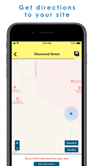
Now you can view your roadway horizontal alignment and roadway stationing on your iPhone! By utilizing the horizontal alignment data for your roadway project, you can upload it to instaCEI mobile app using a CSV file, which will allow you to view your location in reference to the roadway centerline.
This can be accomplished in 5 easy steps:
1- Utilizing your roadway design CAD software, export your horizontal alignment data (XML Report) on the centerline at a 100 foot interval;
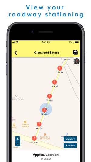
2- Using ArcMap, convert your exported data from Easting and Northing (x,y) to longitude and latitude in decimal degree format;
3- Save your converted data in an excel spreadsheet with 4 columns; station, radial direction, latitude, and longitude;
4- Export your spreadsheet to a CSV format and save it on your phone;
5- Open InstaCEI app and upload the CSV file.
for visual instructions, go to instacei.com
支援平台:iPhone