
價格:免費
更新日期:2020-07-10
檔案大小:117.2 MB
目前版本:21.7
版本需求:系統需求:iOS 10.0 或以後版本。相容裝置:iPhone、iPad、iPod touch。
An app to satisfy all your Fishing and Boating's needs, developed with the help of expert boaters. Download the best up-to-date Nautical Charts to safely enjoy the new boating season. With the Aqua Map Master transform your device in a real ChartPlotter.
►► Features:
• Optimised for both iPhone and iPad
• Download the charts on the device for offline use
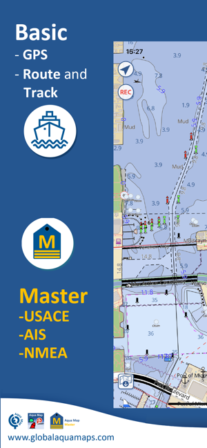
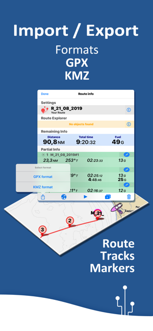
• Plan and navigate your ROUTE and (- NEW!!! -) a Tracks with real-time information
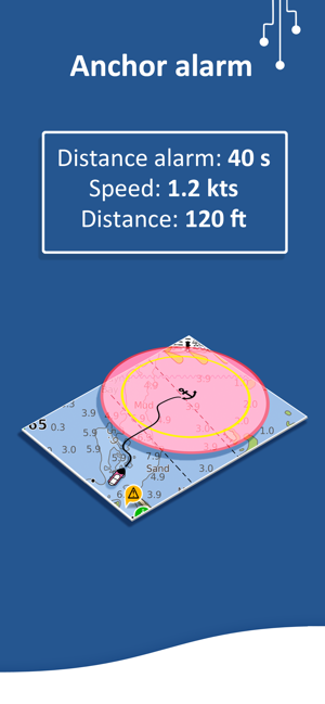
• Anchor alarm with advanced configuration

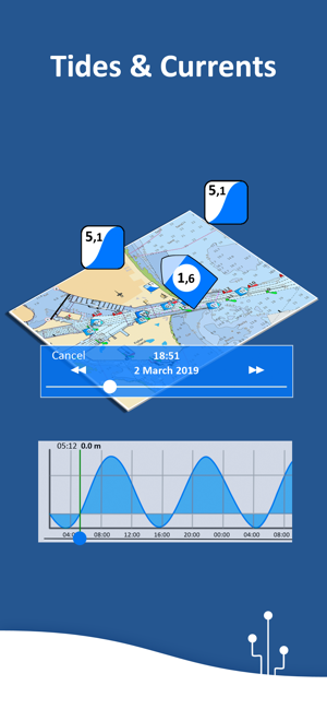
• Tides & Currents prediction and simulation (only US & Canada)
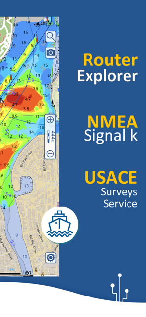
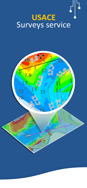
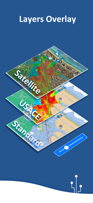
• Overlay the USACE surveys and USCG List of lights on top of your charts (only US)
• Share and load tracks, markers and routes (KMZ and GPX)
• ActiveCaptain & Waterway Guide community integration
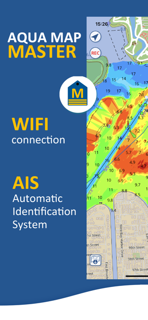
• Connect your NMEA devices through WiFi
• Display AIS info from external devices with automatic collision detection
• Powerful search with advanced settings
• Use the bird view to better see what's in front of you
• Overlay the Satellite images on your map
• Fully support iOS 13 Light/Dark aspect
• Measure distances on the map
• Check all the bridges, hazards and best fuel prices along your route
• Works perfectly in iPad multi-screen mode
• Optimized battery usage
► MAPS
Aqua Map uses only official Nautical charts with depth contours, buoys, lights, etc. to enjoy the best boating experience. You can download the maps at home within your device and use them on the boat offline (no more Internet connection required). Our charts are derived in part from material obtained from: NOAA, CHS, BA, BSH, IIM, CNIG, AHS, NLHO, Explorer, etc.
Available areas: US, Canada, Bahamas, Caribbean, Bermuda, Mexico, Brazil, Argentina, UK, Ireland, France Med, Spain, Portugal, Italy, Germany, Netherlands, Belgium, Norway, Croatia, Estonia, Malta, Australia, New Zealand, Seychelles, Maldives, Emirates, South Africa.
► ROUTES and WAYPOINTS
Plan your trip, insert and edit waypoints. Navigate your route and your track (NEW) to monitor distance, time (ETA) and direction toward your next waypoint or your final destination.
► ANCHOR ALARM
This function will check in realtime your GPS position against your anchor position previously defined. An acoustic and visual alarm will run as soon as your GPS position is out of the defined range.
► TIDES & CURRENTS
You can calculate the prediction for more than 6800 stations in the US & Canada. See the T&C trend on the map and simulate any future date.
► LOADING and SHARING
You can share your favorite's markers on Facebook or send an email with your last daily track. Not only, you can also load any KML, KMZ, GPX (also zipped) found in internet or received from your friends.
► ActiveCaptain
Join the community of more than 100.000 boaters who write reviews, update data and provide up to date hazard information.
► Waterway Guide
Marinas, hazards, anchorages, bridges, free docks and much more to cover the entire US coastline.
► Aqua Map Master
With this subscription you will be able to access a set of advanced functions that will transform your device in a real ChartPlotter (.. and more).
Connect your NMEA (and SignalK) devices through the WiFi and use their data for all the App functions (eg Anchor Alarm).
Display the AIS targets on the map with automatic collision detection.
Display the last USACE surveys and the last USCG List of Lights (only US).
Consult the Route Explorer with anchorages, bridges, hazards, marinas and best fuel prices (now available also for tracks).
► TYPE OF PURCHASES
- Unlimited: you can download and update your charts forever.
- Subscription: it is a one year auto-renewable subscription, it will automatically renews unless auto-renew is turned off at least 24-hours before the end of the current period. Subscriptions may be managed by the user and auto-renewal may be turned off by going to the user's Account Settings after purchase.
Terms of Service: http://www.globalaquamaps.com/Acknowledge.html
Privacy Policy: http://www.gec-it.com/GEC-privacy.pdf
支援平台:iPhone, iPad