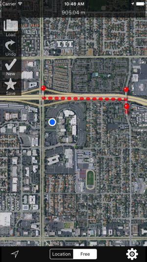
Measure the distance between two or more pins on the map. (as the crow flies) To set a new pin tap a
看更多 »地圖與導航
Air-Line Lite
Measure the distance between two pins on the map. (as the crow flies) To set a new pin tap and hold
看更多 »Aira – Visual Info On Demand
Aira is an app-based service for the blind and low vision. The Aira app fills the visual information
看更多 »Airborne Flight Instrument
This app is an intelligent flight instrument that reads altitude. It is designed for devices that co
看更多 »Airborne Flight Reporting System
Built by pilots and aerospace engineers to provide an affordable solution for Flight Data Monitoring
看更多 »AirCalc
Displays relative wind with a moving arrow.Displays components for crosswind and head/tail wind. Pre
看更多 »Aircraft Altimeter
This photorealistic altimeter simulates the analog altimeter commonly found in general aviation airp
看更多 »Aircraft Heading
Displays a photorealistic aircraft style heading indicator on your device. Modeled after analog inst
看更多 »Aircraft Horizon
This application is a photo-realistic aircraft Artificial Horizon indicator, also known as an Attitu
看更多 »AirDB Civil Helicopters Data
The most comprehensive civil helicopters performance data in your pocket - made by aviation professi
看更多 »


